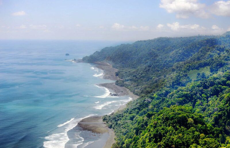

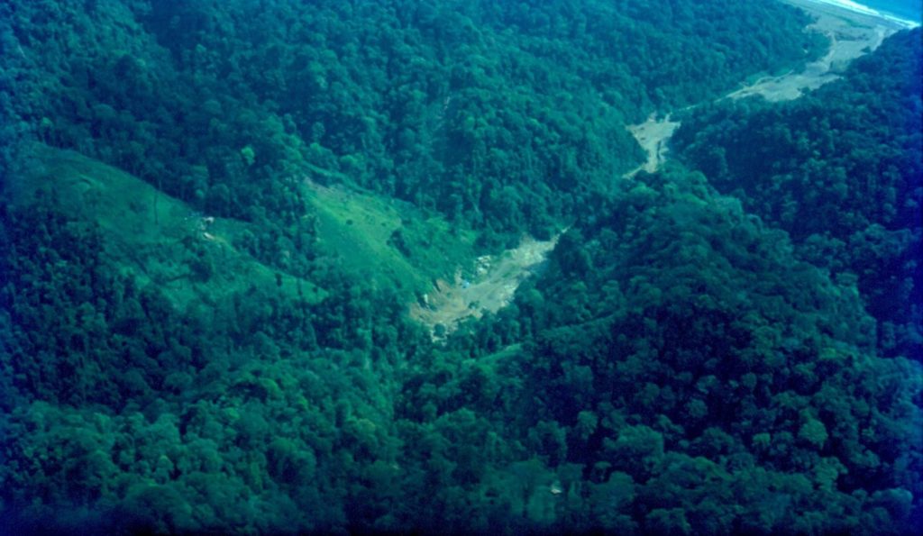
The history of the Osa Peninsula is steeped in mystery, and at one time this biologically intense place was a part of the ocean floor. However, as the volcanoes continued to erupt and the tectonic plates collided, an unbroken land bridge between North and South America formed, and the Osa Peninsula rose above the surface of the water. The land bridge between the great continents is in large part responsible for the incredibly high biodiversity found in this area.
Humans have visited the Osa Peninsula as far back as 6,000 BC, and various indigenous groups such as the Chiriquí and Borucas hunted in the lush rainforest of the peninsula.
Some 20 years after Christopher Columbus lands on the beach near Limon, explorer Gil Gonzalez Dávila met a local cacique or tribal chief named OSA, hence the name of the peninsula. Then in 1569, Sir Francis Drake visited the shores of the OSA and was alleged to have buried a treasure somewhere along the coastline, that has yet to be discovered.
As the next couple of centuries passed, the Osa became a place that time forgot. Then in the 18th-century, a Spanish naturalist named Fernandez de Oveido who was visiting the region was awestruck by the rich stock of flora and fauna. His plea to the locals was to take care of the forest, but his words went unheeded, and well into the 20th century clearing the jungle was considered the best way to improve the land.
In 1821, Costa Rica gained its independence from Spain, but most of the indigenous people of the Southern Zone were killed or driven out by the introduction of foreign diseases and coerced labor. The Osa Peninsula most likely became uninhabited, and the forest cover throughout the area expanded.
In 1848, Costa Rica became a Republic, and around that time, a colony of Panamanians were the first to migrate to the area around the Golfo Dulce. The Costa Rican president at the time sent a mission of colonists to compete. At that point in time, cattle became king on the Osa Peninsula.
By the end of the 19th century, a few naturalists had visited the Osa Peninsula. They faintly signaled that the Osa could someday become a territory of fundamental research. In the 1890s, a government-funded expedition focused on accurately mapping the southern region, intended to help legislators learn ‘just what was theirs and how best to exploit it’. This was also about the time that the original village of the Osa Peninsula, Santo Domingo, was taking root.
In 1910, the town changed its name in honor of the first president to ever visit the Osa Peninsula, Ricardo Jimenez. At the time, the settlers of the Osa processed and sold coconut derivatives and other local produce to passing steamships. Also around this time, the Osa was gaining a reputation as a place to drop off criminals in the most remote locations of the peninsula. The natural barriers of the area basically isolated these lawless individuals to a life of fending for themselves in the wilds of the last frontier.
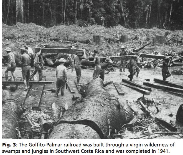
In the 1930s, things started to change on the Osa. The United Fruit Company (UFC) decided to desert the Atlantic region and to move to the Pacific side because of a deterioration of the land near the Caribbean coast. In 1937, the UFC moved to the Pacific on a land swap with the government and ended up owning much of the territory outside the Osa’s previously settled areas. To the locals, UFC was known as “el pulpo”, the ‘octopus’. Also, Puerto Jimenez was an agricultural town of a few hundred that became home to the Costa Rican Banana Company (a subsidiary of United Fruit Company) which was exploiting hardwoods and exploring the Pacific lowlands of Central America for precious woods and to increase their plantings of banana and oil palm.
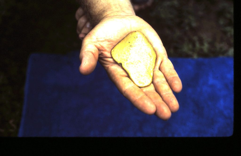
Also at this time, gold was discovered on the Osa. This is where myth and storytelling shade the truth. Some say it was the criminals who discovered the valuable metal when they were left to live or die on this natural penal colony. Others say it was a settler who found gold dust in a shell on the beach. Whatever the truth might be, the Osa was now gaining notoriety as the last frontier, which was lawless yet full of opportunity. Gold mining began in earnest in 1937 on the Gulfo Dulce side of the Rio Tigre. The gold miners reached the Madrigal River, limit to present-day Corcovado National Park, in 1939. After discovering gold in the sand on the beach there, a “gold rush” began, complete with a movie theatre, general store, brothel and bar. This was short-lived.
In 1938, Puerto Jiménez had grown into a slightly larger and less demure frontier town gaining an airstrip with passenger flights to San José.
Big mining companies descend on the Carate River in the 1940s. And in 1943, the United Fruit Company company determined the Osa’s soils, topography, and accessibility were not apt for banana production. Shortly after, the company deeded all 13 of its Osa properties comprising 47,513 hectares (117,357 acres), about one-third of the peninsula, to a retiring company engineer.
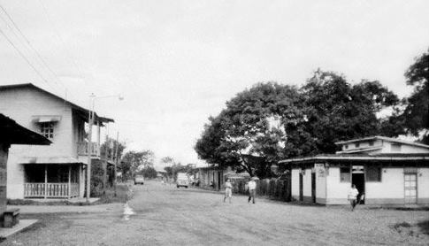
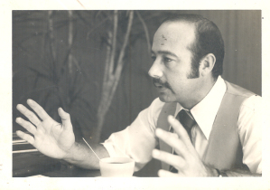
In the 1950s, Puerto Jimenez town center was moved to its present location. “In those days the streets were grass,” says Anita Polanco, who initially arrived on the Osa in the late 1930s in search of gold… “It was a very small place, and all the families knew each other. There were the Quintero, the Cevallo, the Aguirres, the Chavarria, the Pinzon family, the Lescano, the Francesqui, some 25 families … “.
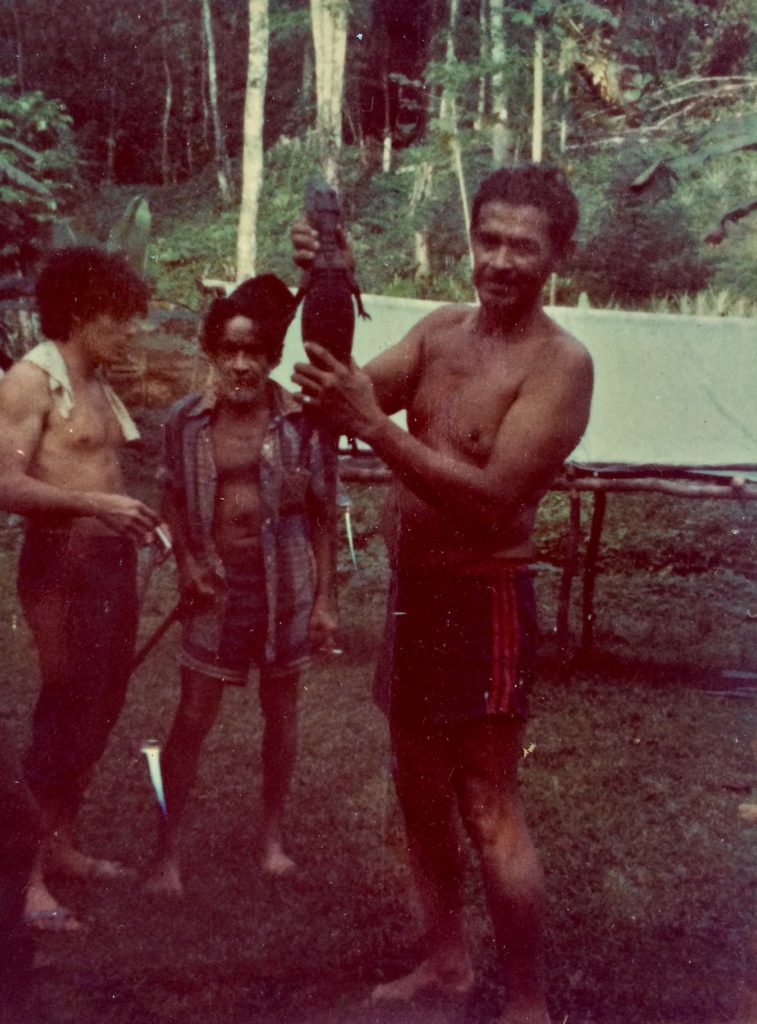
Professional crocodilian hunters had hunted caiman and crocodiles around Corcovado between 1944-69, harpooning, skinning and selling their hides in Puntarenas for exportation to Japan. Their business disappeared in the late 1960s when plastics imitating animal skins destroyed the hide market.
In 1957, a U.S. owned company Osa Forest Products (OFP) bought the 47,513 hectares of forest on the peninsula for $450,000 from the engineer’s widow. OFP was legally registered in Costa Rica in 1959 and given permission for forestry and mining concession of the Osa, which totalled 61,660 ha. Some squatters on OFP land had settled the territory over 40 years before OFP had arrived.
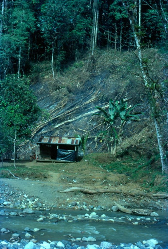
Beginning in the 1960s, there was increasing pressure on the forested regions of the Corcovado basin to convert them to pasture. The same pattern occurred on the east side of the Osa Peninsula, which had two-thirds of its landscape deforested with over 10,668 head of cattle by 1973.
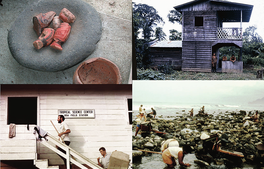
In a little twist of irony, the manager at OFP Alvin Wright invites Leslie Holdridge (co-founder of the new San José-based Tropical Science Center TSC) and Joseph Tosi (TSC co-founder) to open a field station on OFP property at Rincon. They erect the Rincón de Osa field station building just south of the OFP airfield. The Organization for Tropical Studies (OTS) was founded in 1963 as a consortium of six United States universities and the University of Costa Rica.
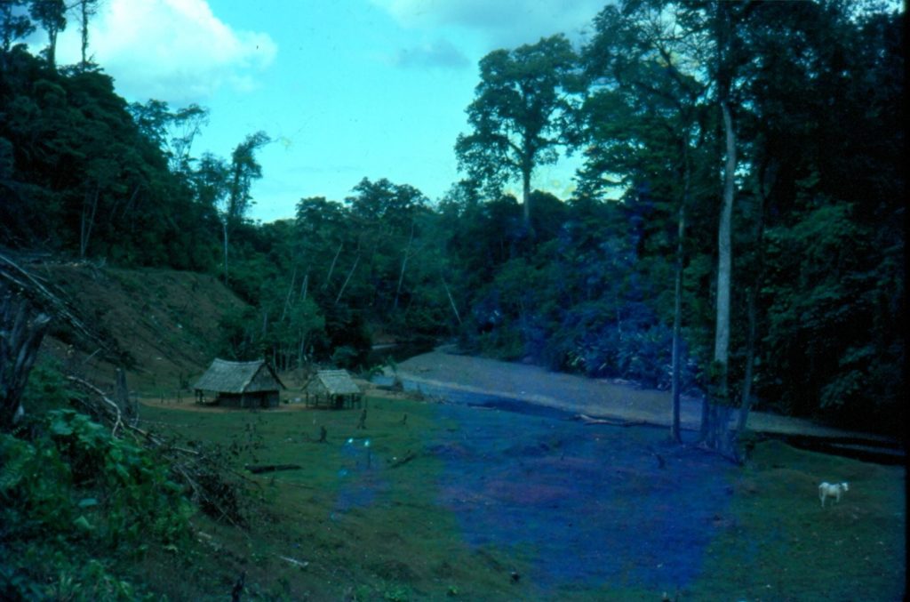
In 1963, a survey found 83 existing homesteads on land titled to OFP. According to one veteran who had settled there in the mid-1960s, the entire population of the ‘gold rivers’ of the peninsula in 1967 comprised just eleven gold mining families.
Between 1962 and 1973, over a thousand scientists visited this tropical research outpost. Their environmental land use studies, along with conservation-oriented activity, soon provoke a revolutionary shift on the Osa. Curiously, this movement was promoted right under the nose of OFP, who would be directly affected by the actions of the scientists. Finally, in 1973, OFP shut down the TSC station due to the campaign that TSC and OTS scientists were carrying out to create a national park on OFP land in the Corcovado Basin (Cuenca del Corcovado).
By the early 1970s, things started to heat up on the Osa Peninsula. Control of its natural resources was at the center of the battle. The settlers and goldmines were coming up against the OFP in a fight for land rights. The foreign scientists were making inroads in defining the Osa as a jewel of fundamental research. And the Costa Rican government started taking notice as the Communist Party was getting a foothold in the southern zone and stirring discontent.
Between 1971 and 1973, charges of tax evasion, land-hoarding, repressive actions against settlers, corruption and other activities were leveled against OFP by congressmen from Costa Rica’s national legislature. OFP’s manager began massive road construction to force evictions in its holdings. Armed squatters captured OFP staff and a tractor in the Corcovado Basin, and warned that if OFP persisted in its attempts to evict settlers on their land, “blood would flow”. OFP asked the Rural Guard to come to its rescue, but they were weary.
In 1972, Christopher Vaughn, a Peace Corp volunteer, working under Alvaro Ugalde (Costa Rica National Parks), drew on the legacy of the Rincon Field Station and started looking at the OSA as a new national park. The scientists were wolves in sheep’s clothing concerning their use of OFP property while supporting the creation of a national park on the OSA.
Between 1972 and 1974, the Osa Peninsula’s population doubled. Construction of the Inter-American Highway South promoted the migration. OFP turned the focus of its energy towards resort development. They used strong-arm tactics to frighten settlers off OFP land. Hostility between OFP and locals continued, and in late 1973, an OFP guard was killed. There were 1,160 farmers occupying about 10,162 ha or 21% of OFP lands at the time.
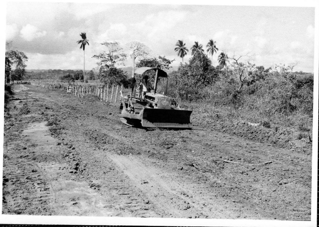
In 1974, a dirt road connected the eastern coast from Rincon to Puerto Jimenez, the capital town with 600 inhabitants. There was no agricultural mechanization on the Osa Peninsula. Corn, rice and beans were planted in primitive ways, using a stick or hand-casting. Slash and burn agriculture was still prevalent. OFP started a new phase in their attack on the land… make money out of the OSA whether through gold dredging in the laguna, forestry, cattle ranching, or creating their own private park. Moreover, with the dry season coming, squatters started filing land claims to begin clearing the rainforest. There was also a Japanese company, Mitsui, planning to contract the Osa forests from OFP and grind it into chips.
By 1975, OFP had lost all control over the squatter’s situation. Chris Vaughn wrote at the time… ‘not one square meter it the Corcovado plain or in the nearby hills was not marked with boundary lines and claimed by an owner’. These were mostly speculators looking to clear land to resell at inflated prices. In the Corcovado Basin , gold miners spent most of their time panning for gold in the Claro river watershed. Most had no property, but travelled between claims, building temporary shacks along the rivers and streams. Their earnings averaged about US$15 a month. Few struck it rich, but many caught gold-fever.
By the end of 1975, OFP knew their lands on the OSA where being considered for expropriation so went to the president of Costa Rica to talk about a land swap. In October, President Oduber signed a degree exchanging lands of the OSA Corcovado Basin for the territories of the surrounding Baldios Nacionales. On the same day, he signed a decree establishing ‘Parque Nacional Corcovado’ in the Corcovado Basin… and a paper park was created. Costa Rican law requires that squatters be compensated in full for any “improvements” they make to land occupied for three months or longer before they can be removed. The National Parks Service original estimate of $176,000 for setting up the park (mostly to buy out squatters) later rose to at least $1.2 million.
Corcovado National Park (CNP) was the first Costa Rican park justified only based on its ecological and scientific merits, without reference to cultural attributes (like Santa Rosa) or recreational benefits (like Manuel Antonio).
In 1978, the Costa Rican government acquired the remaining OFP 16,000 hectares. They were also successful at relocating the approximately 300 farmers, along with their livestock, to the eastern side of the peninsula. However, the gold miners remained entrenched.
Corcovado National Park included extensions in 1978, 1980, and 1985.
In the early 1980s, dirt roads came to the Osa when president Oscar Arias signed the ‘Roads for Peace’ project with Ronald Reagan. The Osa exploded with a perfect storm of calamities that included: the collapse of the banana business in the gulf with widespread unemployment; the spillover from the wars of Nicaragua, El Salvador, and the contagious narco-militarism of Panama; gold peaked at atmospheric levels, and another gold rush began.
By 1983, an OSA gold rush was well underway due to the rising gold prices, economic crisis, local agriculture problems, and phony investment schemes. The Rural Guard evicted 1,500 miners from the park. A new Corcovado management plan was launched to deal with the invasion. Park headquarters moved from Sirena to Cerro de Oro to combat the miners. Alvaro Ugalde asked President Monge to declare the OSA in a state of emergency in 1985, and University of Pennsylvania biologist Dan Janzen was asked to conduct a study on the impact of gold mining in and around the park. It was his recommendation that led to the complete eviction of miners in 1986.
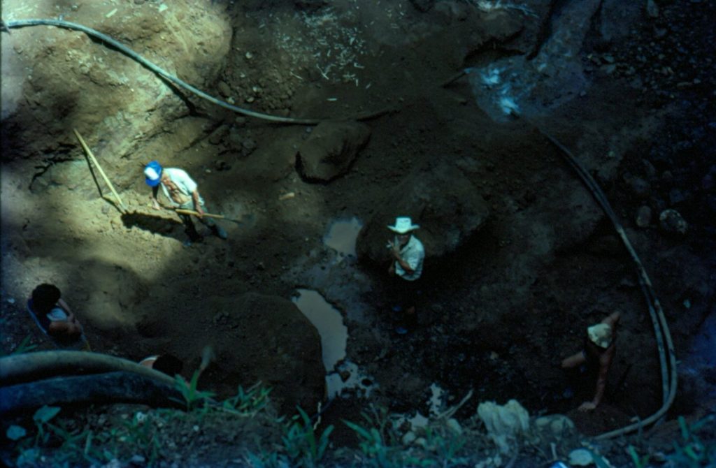
It was estimated that 2,000 miners were working in the rivers and on the beach in 1984. A government study in 1985 confirmed that 1,500 gold miners were working illegally in the park and an additional 3,500 were working in nearby areas. According to an estimate, the community above Madrigal Beach had approximately five hundred inhabitants living in two hundred makeshift houses.
In the 1990s, the U.S. Army Corps of engineers got busy building roads, bridges and schools on the Osa Peninsula while at the same time keeping a close eye on all of Ollie North and Noriega activity in the mountains high above the city of David, Panama.
In 1993, there was a campaign against the construction of U.S. corporate subsidiary Ston Forestal’s wood-chipping plant in an ecologically vulnerable location adjacent to the Golfo Dulce. This successful campaign, inspired and in part led by AECO (Costa Rican Ecologists’ Association), became a mostly Osa grassroots enterprise. This effort raised the ecological and conservation consciousness of many longtime Osa Peninsula inhabitants and served as a basis for interest in later local conservation agendas.
The government of Costa Rica at this time also widely married its economic future to the relatively new concept of ecotourism as Costa Rica became one of the world’s most prominent examples of sustainable development. In the 1990s, the last of the big mining companies left the Osa, and the first full-service eco-lodges on the peninsula such as Crocodile Bay started to develop.
And with that, ecotourism takes hold.
~ This article was written by Chris Graham
[/et_pb_text][/et_pb_column][/et_pb_row][/et_pb_section][et_pb_section fb_built=”1″ theme_builder_area=”post_content” _builder_version=”4.14.7″ _module_preset=”default”][et_pb_row _builder_version=”4.14.7″ _module_preset=”default” theme_builder_area=”post_content”][et_pb_column _builder_version=”4.14.7″ _module_preset=”default” type=”4_4″ theme_builder_area=”post_content”][et_pb_code _builder_version=”4.14.7″ _module_preset=”default” theme_builder_area=”post_content” hover_enabled=”0″ sticky_enabled=”0″][/et_pb_code][/et_pb_column][/et_pb_row][/et_pb_section]